Category
| You're no bot and a page you've created got automatically deleted? Add your name to FreewarWiki:NoSpamUser |
Difference between revisions of "Template:Minimap"
From FreewarWiki
(-) |
|||
| Line 1: | Line 1: | ||
<!-- Variablen-Setup | <!-- Variablen-Setup | ||
Abstand Unterkante Felseninsel/Unterkante Belpharia-Inseln sind 12 Felder; *Height* entsprechend angepasst | Abstand Unterkante Felseninsel/Unterkante Belpharia-Inseln sind 12 Felder; *Height* entsprechend angepasst | ||
| ŌłÆ | -->{{ | + | -->{{MapsMetaData|}}<!-- |
-->{{#vardefine:prefix|{{#var:prefix{{{Area}}}}}}}<!-- | -->{{#vardefine:prefix|{{#var:prefix{{{Area}}}}}}}<!-- | ||
Latest revision as of 03:01, 9 April 2018
[Edit] Documentation
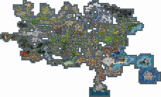
This template creates a minimap of Freewar, combining several image files into a single image.
Usage
This template can be include with {{Minimap|"1"|"Area"|"Size"|"Image"|"itolosImage"|"frozenislandImage"|"belphariaImage"}}.
Parameter
- 1: Optional placeholder for own additions.
- Area: Specifies an optional prefix for an area.
- Size: Sets an alternative size, by default 5px.
- Image: Specifies an alternate image file for the main continent of Freewar.
- itolosImage: Sets an alternative image file for the area Itolos.
- frozenislandImage: Sets an alternative image file for the area Frozen Island.
- belphariaImage: Sets an alternative image file for the area Belpharia.

